
To understand the events recorded in the New Testament, it's important to appreciate the context in which they took place. This includes the geographical, historical and religious context. This series of 3 Bible studies aims to help you understand this context.
We start with the geographical background to The Bible Journey.
The Geographical context of the New Testament
We're going to look in more detail at the page entitled The Landscapes of Palestine in The Bible Journey @ www.thebiblejourney.org.
1. Read the opening paragraph of The Landscapes of Palestine (below) and look at Map 1 & Fig.1 (which follow the opening paragraph).
The Landscapes of Palestine
The New Testament tells the story of Jesus as a man on the move. He spends much of his ministry travelling from place to place, moving frequently from Galilee, in the north of Israel, to Jerusalem, 65 miles / 105 km to the south, in Judaea. The key events of the New Testament unfold in the context of these numerous journeys across four very different landscapes of Palestine (see Map 1 and Fig. 1):
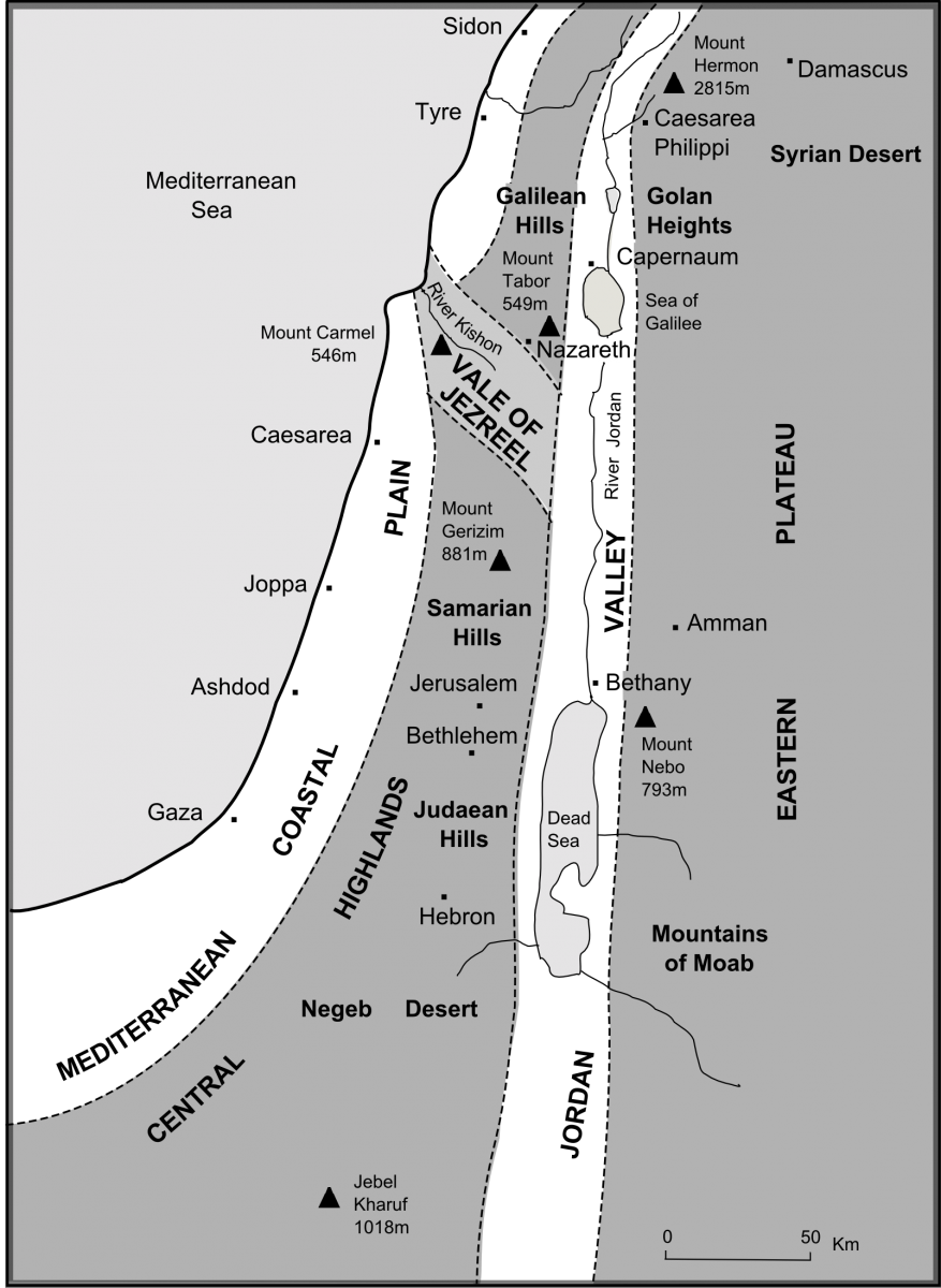
Map 1 Landscapes of Palestine
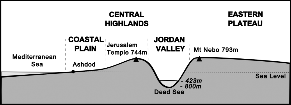
Fig 1 Simplified cross-section
2. Do you recognise any of the names?
Look at each of the 4 landscapes in turn. In which two of these landscapes does most of the action in the gospels take place?
3. Read the paragraph on The Central Highlands and look at the photo.
The Central Highlands
Jesus of Nazareth is born at Bethlehem in the hill country of Judaea. He is brought up in the hills of Galilee at Nazareth and – as a child – goes up to Jerusalem in the Central Highlands each year for the Passover festival.
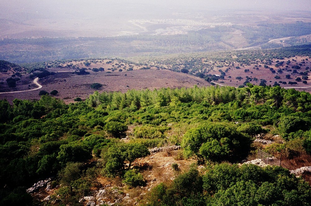
The Central Hill Country of Galilee
4. What do you notice about the vegetation in the foreground?
This upland area is on permeable limestone rocks, so most rainfall percolates through the rocks immediately. This results in scrubland, low trees, bushes and stunted vegetation.
5. Look up Luke 2:4.
Did Mary & Joseph go down to Bethlehem or up? Be careful, here! We're not talking about 'top to bottom' of a map; we're talking about the altitude of Nazareth (which is much lower than Mt Tabor, the highest hill in Galilee - it's height is shown on the map) and the altitude of Bethlehem (not much lower than the Temple in Jerusalem - whose height is also shown on the map).
6. Read Luke 2:39-42.
Note that Jewish pilgrims always went up to Jerusalem! You might like to read one of the 'Songs of Ascent' in the Psalms at this point e.g. Psalm 122.
7. Read the paragraph on The Jordan Valley and look at the photo (which is looking east across the valley floor from the Galilean Hills).
The Jordan Valley
John the Baptist challenges people to change their lifestyle at Bethany in the Jordan Valley. Jesus is baptised in the River Jordan and moves to Capernaum – a fishing port on the Sea of Galilee – where he recruits his first disciples and establishes the main base for his ministry.
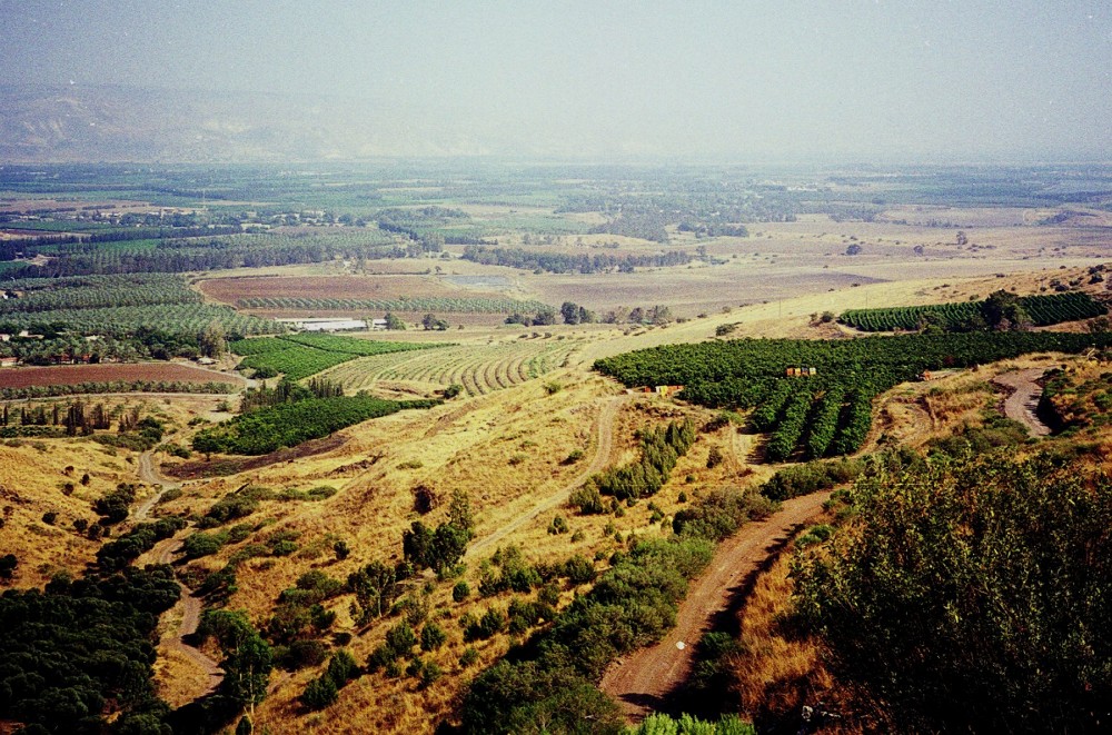
The Jordan Valley near Deganya
8. Can you spot the River Jordan on the wide valley floor near the back of the photo? The river is only a few yards / metres wide at this point, so you probably can't see it!
Can you see the Eastern Highlands rising steeply from the valley floor at the top left of the photo?
9. Read John 1:26-36 & Matthew 3:13-17.
Look at Map 1 again and find the location of Bethany. Why was it called 'Bethany beyond the Jordan'?
10. Read Mark 1:14-21.
Was Galilee in the Central Hill Country or the Jordan Valley? It actually depends on whether you mean Upper or Lower Galilee - and the New Testament often doesn't tell us which it's talking about!
The Sea of Galilee (also called Lake Galilee or Lake Tiberius) is on the floor of the Jordan Valley. It is well below sea level and is about 3800 ft / 1160 m below the altitude of Jerusalem. As temperatures decrease with altitude (by about 2.0ºC per 1000 ft / 3.5ºF per 1000 ft / 6.5ºC per 1000 m ) where is it hotter? - Jerusalem or Lake Galilee?
As the area surrounding Lake Galilee is much warmer than the Central Hill Country of Upper Galilee and the Judaean Hills near Jerusalem, it's not surprising that Jesus spent most of his outdoor ministry teaching in the area surrounding Galilee!
Where did Jesus choose as his mission base? (If you're not sure, you'll find it on the map beside Lake Galilee & in Matthew 4:13.)
11. Read the paragraph on The Mediterranean Coastal Plain.
The Mediterranean Coastal Plain
After the birth of Jesus, Mary and Joseph flee across the Mediterranean coastal plain to Egypt to escape the murderous wrath of Herod the Great. During his ministry, Jesus visits the Mediterranean coastal towns of Tyre and Sidon. Later, Peter has a vision beside the Mediterranean Sea at Joppa, and agrees to meet a centurion at the Roman port of Caesarea.
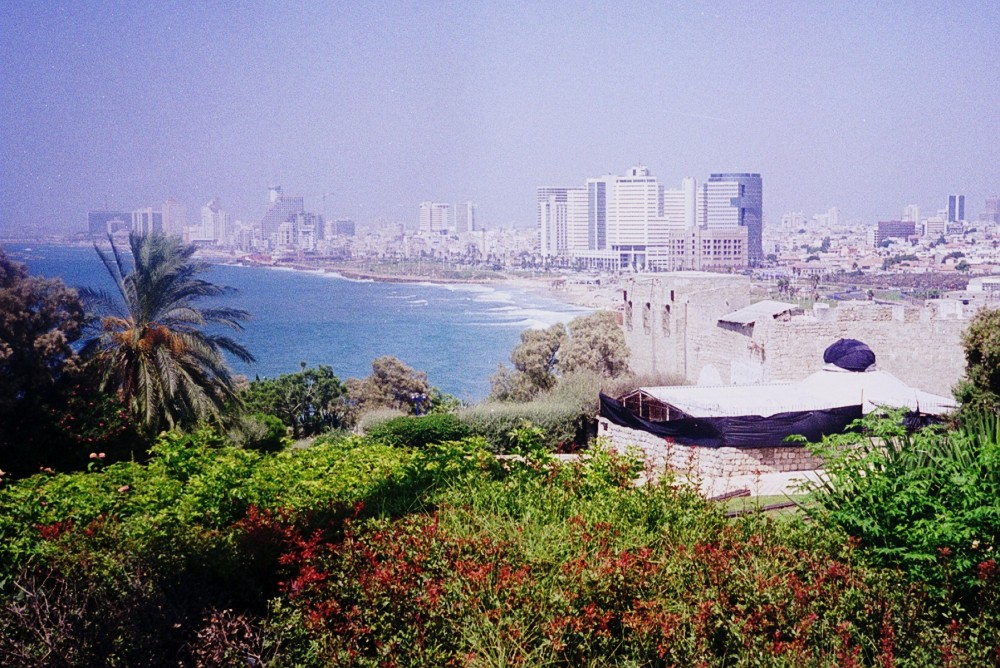
The Coastal Plain near Joppa
12. Read Matthew 2:13-15, Mark 7:24-31 & Acts 10:1-8.
Would Egypt have been warmer or colder than Bethlehem? What about Joppa & Jerusalem? How about Tyre compared with Lower Galilee?
13. Read the paragraph on The Eastern Plateau and look at the photo of Ein Gev on the eastern shore of the Sea of Galilee.
The Eastern Plateau
Jesus travels with his disciples to the source of the River Jordan near Caesarea Philippi before he is transformed before their eyes on the summit of Mount Hermon. Paul climbs the Golan Heights and journeys across the Eastern Plateau towards Damascus, where he sees a blinding light and hears the risen Lord Jesus saying to him, “Why are you persecuting me?”.

The Eastern Plateau rising above the eastern shore of the Sea of Galilee
14. Look up Mark 5:1. The region of the Gerasenes was in this area, on the eastern shore.
How do we know that this healing didn't take place on the western shore? (See 5:11 for a clue!)
15. Read Matthew 17:1-8.
Locate Caesarea Philippi & Mt Hermon on the map. How high is Mt Hermon? Verse 2 becomes even more fascinating when you realise that the summit of Mt Hermon is covered in snow all the year round! You might like to discuss the significance of this to the onlookers.
16. Read Acts 9:1-4.
Find Damascus & the Golan Heights on the map.
Which route would Saul / Paul have taken from Jerusalem to Damascus?
Why would he probably have avoided the Samarian Hills?
How many miles / km had he travelled along dusty roads before his encounter with the risen Lord Jesus on the outskirts of Damascus? (50 km on the scale bar on the map is about 30 miles)
Does this tell us anything about his physical condition at the time of this encounter?
Look out for these four landscapes when you read about journeys in the New Testament!